North Country National Scenic Trail Map by Myrmel Maps
Product Description
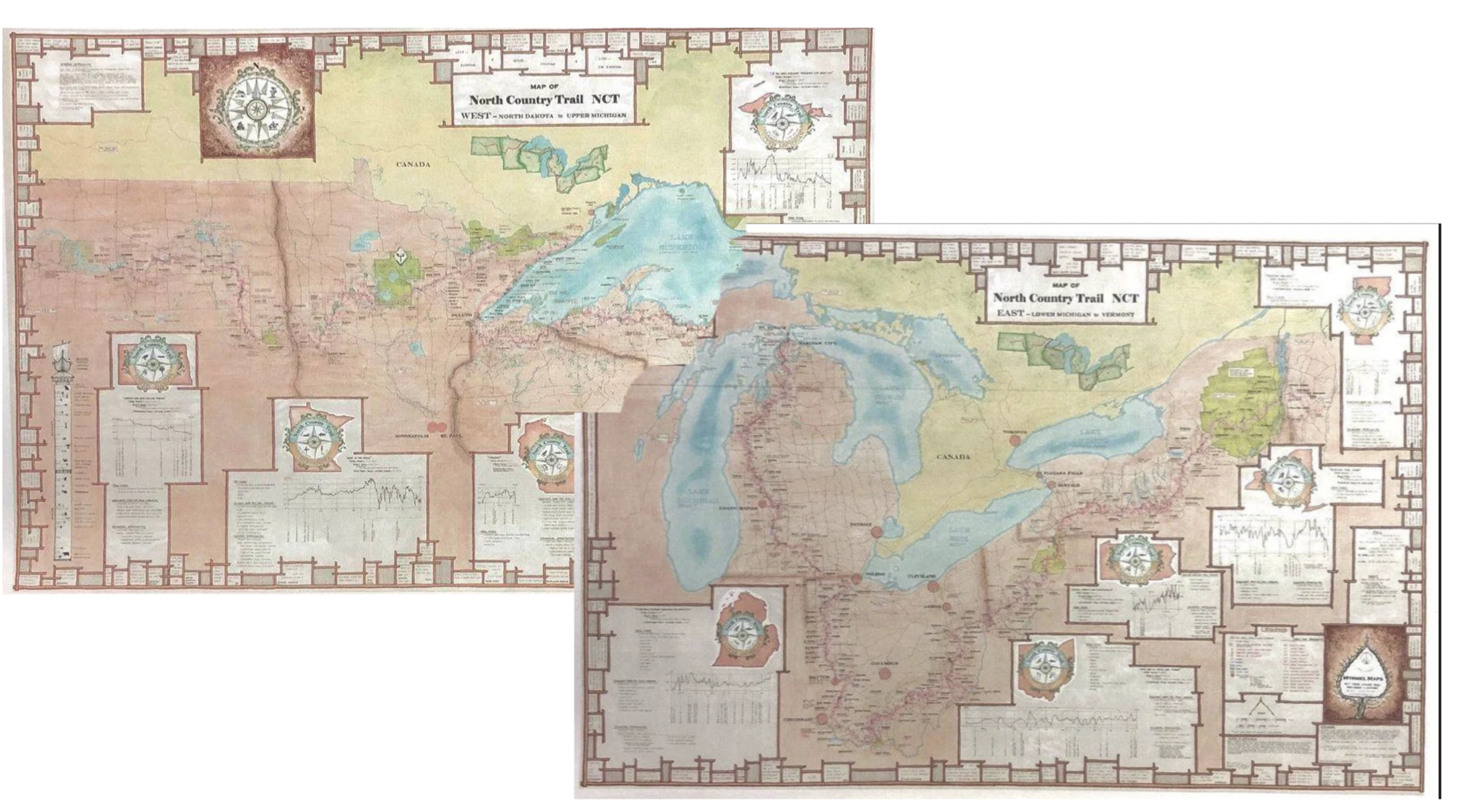
The map covers the North Country National Scenic Trail (NCT). The longest National trail, 4,800 miles, from North Dakota to Vermont.
This waterproof map, printed on both sides of the paper, shows details for each State the trail passes through and connections on the east with the Vermont Long Trail and Appalachian Trail, and on the west end to the Louis and Clark Trail via the Missouri River.
Map size = 25" x 39"
This map is designed to fit together, offset as shown.
Made by a Minnesotan, printed in Minnesota entirely a USA product
Price includes tax and shipping in USA.
Product Details
Approx. Price:
$34.00 (Click to View Price Changes and Options)
Brand:
Myrmel Maps
SKU:
MM01
Manufacture ID:
180
Reviews for North Country National Scenic Trail Map
No Reviews -