BWCA Entry Point, Route, and Trip Report Blog
June 02 2024
Entry Point 47 - Lizz & Swamp Lakes

Number of Permits per Day: 3
Elevation: 1864 feet
Latitude: 48.0420
Longitude: -90.4998
Lizz & Swamp Lakes - 47
Captain Morgan
Entry Date:
September 21, 2010
Entry Point:
Morgan Lake
Number of Days:
9
Group Size:
2
Wanting to make it up to Grand Portage National Monument and still get to our Tuscarora outfitters bunkhouse before dark, we set off fairly early this morn'.
Making it to Grand Marais by lunch time. Fueled up the van, then stopped off at My Sisters' Place to eat. This venue is merely an in-town extension of Trail Center as they have the same decor & menu. Also, like Trail Center, the food was excellent.[paragraph break]
It had been some years since I'd ventured north past Grand Marais on hwy 61 & was the first time for Vickie. It was a gorgeous day & the kaleidoscope of autumns' hues were beginning to reveal their splendor. So we took our time languidly driving along enraptured by the juxtaposition of leaves, rocks, & water.[paragraph break]
As we sauntered up to the visitor center there was a robust "Voyaguer" just leading a group of folks out on a guided tour. We readily joined in. I had some knowledge of the voyaguers colorful past, but was really enlightened as this tour was incredibly informative and even entertaining. How they planted their gardens, how they built birch bark tepees & canoes, what they used for paddles, what they ate, what it was like in the BWCAW & Quetico in those days, & obviously a tour through the fort. There were many interesting artifacts & interpretive stations in the Visitors center as well. Did I mention free admission, though donations are welcome. We talked afterwards about possibly coming back next year during Rendezvous days. I strongly urge anyone who has an interest in the early history of BWCAW & canoeing to stop in. You won't be disappointed.


 [paragraph break]
Instead of driving all the way back to Grand Marais, we opted to take 14 north and intersect Gunflint Trail further up. It was a narrow undulating road that likely didn't save us any time. But, it offered an even wilder experience & exploration of previously unforseen terrain. Which is always a good thing.[paragraph break] Pulled into Tuscarora Outfitters at about 5. After securing our permit, Andy suggested we explore the Centennial hiking trail which starts near the entrance of their driveway. At the trailhead were pamphlets explaining fragments of the history about the area at each of the numbered stations along the way. Much of it was about the old Paulson mine & the railroad grade that ran through here. Along the way there were a few wonderful vistas overlooking a swamp. Off in the distance, Gunflint lake even came into view. 
 [paragraph break] We made it approximately 1/3 of the 3 mile trail (which covered most of the interpretive stations)when we decided to head back the way we came. As we climbed up to the ridge overlooking the swamp I noticed a large dark object below. We watched from the relative safety of the ridge as a bull moose lumbered his way across the length of the swamp. This was the first time Vickie had ever seen a moose in the wild. As the bull was approaching intersecting the hiking trail 50 yards below our position, Vickie figured we'd taken enough photos/videos etc. & should head back to the vehicle;-)
  [paragraph break] Continuing on down the trail with an ever watchful eye looking back, Vickie lead the way to the van. While trying to avert an attack from the rear..... we both nearly collapsed of heart attack as a spruce grouse, who obviously waited until the optimal moment for maximum shock value, flew up right in front of us. I say this because about all the bird did was fly straight up about 5 feet from the ground & perched itself on a branch. Now showing but little concern or fear for our intrusion.
  Daylight was quickly becoming scarce, so we headed back to our bunkhouse abode. After a little reading and pouring over the maps one last time we hit the sheets as we wanted to get an early start.
 We arrived early at the EP. Fortunately one of the 3 parking spaces was available. It was cloudy and the air was still quite crisp as we began our long journey. The trail starts out on a very nice boardwalk. There are several gentle up & downs along the way. The only really challenging climb was at about the 2/3 mark where the trail crosses a small brook running out of a beaver pond. (The climb here is not nearly so bad heading the other way.) Then a long gradual descent to the lakeshore. All in all I'd say a difficulty of about 8?[paragraph break] While coming across, muscles in my lower back began spasming a little. It didn't feel like anything too serious & was not a severe pain, but it did tire me out much quicker. I told Vickie to go on ahead, I'd catch up. So I wound up taking a few "poses" along the way. I finally arrived at the lakeshore perhaps 15 minutes behind her? Vickie was very excited & came running up the trail to meet me. A bull moose had come out maybe 150 yards from the landing on the north shore and proceeded to swim across the lake towards where she presumed the portage into Carl lake was. She couldn't believe how loud it was when the bull shook off the excess water before moving on. I was happy she got to witness this spectacle. I surmised some good came out of my back aching. If I had come down first with the canoe screeching & scratching on all the branches overhanging the trail, perhaps he wouldn't have come out?[paragraph break]
 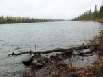 Morgan lake is actually quite nice & we contemplated why it did not have at least one campsite. The weather was now becoming more temperate. Coupled with the sweat we worked up on the portage we began to shed a few layers before paddling across Morgan as it looked as if the sun may indeed soon poke its head out. Soon, the Black Pearl set sail towards Jake. With its unknown adventures on these waters about to unfold.[paragraph break] We startled a few ducks as we pulled up. They flew off voicing their displeasure. Do ducks curse.....? The portage into Jake starts out a little muddy. Otherwise this is about as nice a trail as you would hope to find. Almost completely flat with pine duff & leaves covering much of the path. A shallow, mostly sandy landing awaits on the Jake side.[paragraph break] Wind was not a factor on this day & we made quick work of Jake. The next portage was shorter, but had a rather rocky landing. Also some climbing would be involved, though nothing too serious. The landing on the Vista end was very mucky. In fact, there was a small extension to the trail to avoid the worst of it. I didn't see how to walk the canoe across this extension as there were large branches overhanging that were impossible to avoid. So I sludged through calf deep muck along the shoreline. Didn't want to find out how deep it went further out.
  [paragraph break] We had made pretty good time getting to Vista. I told Vickie to keep an eye out for firewood as we paddled along. Once we got camp set up we could come back & pick it up if there was none in camp. The southern most site was our hopeful home for the day. Way across the lake we could see the northern most site was already occupied. As the Pearl rounded the large peninsula on the NE end of the lake & started veering south our hearts sunk just a bit. It quickly became evident that both of the other 2 sites were occupied as well. Time to put plan B into effect. Flip flopping our itenerary we had no choice but to head for Horseshoe & try to get a site there thus keeping our daytrip plans intact. We surmised we could camp on Vista the last night of our voyage on our way out. [paragraph break] Vista - Horseshoe portage wasn't all that long & the only climbing mandated was that of getting in & out of your vessel. But man for rocks! At both landings & all along the trail. The outlet of the creek on the Horseshoe end was kinda pretty though.
  By this time the sun had officially announced its presence and a beautiful fall day was in progress.[paragraph break] As we slowly drifted north around the last bend before the first campsite we noticed something floating in the water.
  Appeared to be a northern flicker? It didn't look like it had been there too long. Perhaps a hawk had taken it down? We must have frightened the predator away? As no one was coming forth to claim the fruits of their labor.[paragraph break] The southern most site soon can within eyeshot. 2 fellas were sitting on a log out from the site. They told us they were just eating their lunch & we could have the site. We told them we'd check out some of the other spots first. Much to our chagrin we came back awhile later with hat in hand. All the other sites had been claimed. Not that this site was uninhabitable. Just blew me away. First Vista was full & now Horseshoe had this many people on it this late in the year. I always like coming late in the year to these popular areas as normally there are far fewer people. Not the case here. As even several others paddled by later after we claimed the site. Think Grand Central Station. Ah well? Things could always be worse? [paragraph break] The only real drawback of this site was the fact that there was no really nice flat spot for a tent.
 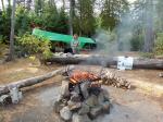 Having gathered up some wood soon we had a fire going. We let 'er burn down a bit as we finished setting up camp. The Horseshoe lake welcoming committee was there to greet us. A triumphverant of whiskey jacks were ready & a waitin' for us to dig out the goodies.
  The flames having subsided I set about grilling our chipolte marinated pork chops. I used some tinfoil as the I don't really care for the forest service firegrates. The spacing is too wide (especially on the ends) thus risking a high liklihood that smaller cuts of meat could potentially fall through. No such problems here though.
 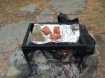 The chops sure turned out juicy & tasty. There is just something special about eating fresh meat out in the wilderness. Obviously it's much easier to do when it's a bit cooler. After dinner I finished splittin' up some firewood then relaxed with some Jimmy Beam mixed in my camelback. Vickie brought Baileys to mix in with her coffee. We sat & watched the night sky as the clouds began to roll in.
  Tomorrow the sea would likely be angry? AARRRRRRRGH! Morgan Lake, Jake Lake, Vista Lake, Horseshoe Lake
Today I would be celebrating my 29th birthday for the 14th time! At first light I got a, "Good mornin' old man" outta Vickie. I tell ya I get no respect. Apparently the weatherman wasn't aware of the situation either as it was cold, windy, gray & cloudy right from the get go. At least it wasn't raining.......yet, but there was a light mist in the air.[paragraph break]
Of course breakfast was my favorite. Pancakes (unfortunately no fresh blueberries) and, as an added bonus, bacon on the side. As we finished breakfast the mist turned to a light drizzle then eventually sporadic rain & gusts of wind. The pre-launch weather report had accurately forecast this day as windy & rainy. So, somewhat reluctantly the decision was made to stick close to camp this day. The consequence of this decision meant that 1 of our 2 planned exploratory excursions from our Horseshoe base would be aborted. A northern loop through Caribou, Meeds, & Pillsbury. Where pre-trip planning intelligence had confirmed that highly decorated BWCA.com luminary, code name mooseplums, would indeed commence being haunted by the waters in the Caribou/Horseshoe area. A high probability of crossing paths would be likely. Also on the itenarary was a southerly jaunt to Little Trout. Where we hoped to do some trout fishing.  [paragraph break] Things being as they were, the bulk of the day was spent finding, sawing, & splitting firewood. We both put rather large dents in the books we'd brought. I also managed to doze off for a time as well.[paragraph break] Eventually restlessness crept up on us. The rain had stopped & the wind had let up as well. Donning our raingear, we took the Black Pearl out for a spin around Horsehoe. Perhaps we would run across mooseplums? First we paddled north. The northern most site was actually open. It would be the only one. Most people seemed to be hunkering down at their sites. As canoes were seen on shore overturned & not alot of noticeable activity going on. We had brought our fishing poles along. The wind was coming out of the east. So true to the saying, fishing was the least. Naturally once we gotten to the extreme north end of Horseshoe the rain picked up again accompanied by reinvigorated gusts of wind. We tried to tough it out for awhile, but eventually we succumbed to mother natures outburst & headed back to camp.[paragraph break] As evening neared the rain relented. Can't say that for the wind. Though it had rained for the better part of the day I was able to get a fire going. No doubt motivated by the desire to have birthday ribeyes for dinner?
  They sure helped make the cold wet day a bit more tolerable. Vickie made me a neat birthday card out of birch bark & also baked me a birthday cake. We tried something new (for us). Cornbread, where you only need to add water. Maybe we got a bad brand? It was baked properly but, we both agreed, it was quite tasteless. Never the less it was a nice gesture & much appreciated. We enjoyed a couple of cocktails & played some cribbage before calling it an early night. [paragraph break]Horseshoe Lake
This day started much the same as the previous. The last forecast we'd seen said the clouds & rain would lift this afternoon. We hoped so. With that in mind we determined to strike out from camp today come hell or high water. We deceided to head for Little Trout. Reasoning that it would be easier to visit the lakes to the north at a later date if necessary. Also it would be the only real trout fishing opportunity we'd have on this time as I'd heard, from several sources, that Winchell was pretty much a dead sea. I guess meeting mooseplums would have to wait? What became the beginning of a trend. We ate leftovers for breakfast. Bacon & the potatoes from dinner. Still very tasty.[paragraph break] Made quick work of the portage to Vista. Though all those rocks were beginning to get on my nerves. Found out after the fact that there are 2 landings on the Misquah side of the next portage. It was near impossible for both of us to get in at the closer of the 2. Very narrow. I had to paddle out into the bay & turn around then come back in to pick up Vickie. Unless you have an aluminum or heavy duty canoe? I'd recommend using the landing further down the trail.  [paragraph break] The next portage was the fabled Misquah - Little Trout Bataan death march. It started out innocently enough taking awhile before the real "fun" begins. I'm not trying to downplay the hills. As they were substantial. In my opinion the worst part(s) were the boardwalks. Also the substatial amount of protruding roots in this section. This was largely due to the fact that it was raining & they were wet. But also they are so narrow & not entirely flat so as to cause one to easily slip & slide. After nearly falling and/or ripping a hamstring a couple times. I decide it would be much safer just to trudge through the muck that these boardwalks ran over. Mercifully the last decent was upon us.
  Definitely an, "O! The joy!" moment. But the celebration can't begin too early as there are some treacherous rocky areas to avoid along the descent down to the lake.[paragraph break] We pulled off at the campsite nearest the portage trail to catch our breath and grab a snack. Unfortunately the sky hadn't opened up yet but it looked like it wanted to. I told Vickie that there are also supposed to be rainbow trout in this lake as well as lake trout. She says she'd really like to catch a rainbow & would REALLY like to see a rainbow today. LOL[paragraph break] We start east then head south trolling the whole way. The west side of the big point on the south end of the lake is where we hit paydirt. Not gonna say we hammered 'em. And Vickie never got her rainbow. Fish or the kind in the sky. But we were happy with just lake trout as it added to the satisfaction of having labored to get here making it seem all the more worthwhile.
  [paragraph break] The lake trout we kept drew the attention of the resident bald eagle. Trailing behind in plain view on a stringer, Ol' baldy made a couple of uncomfortably close dives towards the Pearl while we were paddling about the lake. Enough so that we were paying more attention to where he was perched than to fishing.[paragraph break] We pulled off at the island site for lunch. From shore it looked like this would be an awesome site. But in reality I'd only give it 2 maaaaybe 3 stars. Still it's the best site on the lake. And like most island sites there are trails running in every direction for exploration. Hot bowls of Bear Creeks gumbo really hit the spot.
  [paragraph break] Intermittant rain continued all throughout the remainder of the day. At least the wind hadn't picked up. We finished our lunch. Paddled back out for some more fishing. Checking out the last site along the way. Easily the worst site on the lake. Fishing slowed after lunch so soon we endeavored to return to Horseshoe.[paragraph break] Knowing what to expect the portage itself didn't seem quite so bad this time. The major annoyance I had was due to the rain. While carrying the Black Pearl across the trail, inevitably there were a multitude of overhanging branches. The leafs on said branches, having collected moisture from the rain, rubbed against the canoe thus releasing their watery burden which ran down to the gunales where my hands were. Though I was wearing gloves, quickly they became saturated and the water then began trickling down my forearm. Thankfully it made it no further than my elbows which were creased carrying the canoe. This was where the one new item of gear purchased prior to this trip really showed it worth. We'd purhased Under Armour garments for both above & below the equator. Spendy items to be sure. But I'm here to testify that they are the real deal. Even when dampened a bit (forearm) they wick the moisture away & kept me warm. I felt it was money well spent.[paragraph break] Greeting us at the Misquah end was the ol' north wind. And he was howlin' pretty good. We lingered a bit eating some Clif bars hoping the wind would subside a little. Not sure what prompted us to push off, but that's just what we did. I've paddled in worse wind & waves. But it was still a struggle. Not many opportunities to catch your breath. About 2/3 of the way to the Vista portage we paddled by a couple of guys headed south. They inquired about the campsite on Misquah, then told us the weather tomorrow was supposed to be much nicer. I sure hope so![paragraph break] At first it looked like things calmed down some on Vista. We barely got out of the little back bay when we were hit will the north winds full fury. I surmised the southern most site would be taken. (having seen the 2 guys on Misquah) But we needed a safe harbor & that right quick! Occupied or not. Besides we wouldn't stay topside for very long in these waves. We struggled to make it frequently paddling with all we had just to hold our position. Finally we pulled up & were able to park the Black Pearl. To my surprise the site was not occupied. I haven't had the privilege of being able to hunker down during a wind/rain storm at a unoccupied 5 star site before.
  [paragraph break] We waited out the wind for nearly an hour. Finally it seemed it was dying down. We made a break for it. It was still tough paddling, but we were making steady progress towards the small islands. I noticed the people at thje next site up the lake intently watching our struggle from the safe haven of terra firma. Keeping close to the western shore we paddled a ways into the first arm before trying to cut across to the north. Just as we got headed towards the Horseshoe portage a sudden violent gust of wind caught the Black Pearl & abruptly swung us around to the east. It all happened so fast we didn't have time to react. Humbled, & not wanting to fight the wind, I quickly resolved to ride this gale out to the eastern shore. There, though still windy, we were finally able to proceed northwards and return to camp.[paragraph break] Horseshoe Lake, Vista Lake, Misquah Lake, Little Trout Lake
Woke to yet another gray morning. A quick oatmeal breakfast with some hot chocolate got us going tearing camp down. The clouds were slowly beginning to break. Soon we were packed up & on the water. Destination Winchell. [paragraph break] The first portage encountered was the trail to Gaskin. It started with a fairly tough climb then leveled off before dropping down to Gaskin. At mid trail there were a nice grouping of large pines & cedars. With the fall colors in full display it made for a really cool scenic trail. 
 The landing on the Horseshoe side was quite rocky. Not so bad on the Gaskin end.[paragraph break] The island site was occupied as we paddled by. After our struggles the day before it was so nice to be paddling across Gaskin in mirror form. To say the least, Vickie was not impressed by the mucky landing to the next portage.
  Upon reaching the Winchell end Vickies' first word was, "WOW!" High rolling hills dominate the southern shore. Coupled with a stunning golden glow that only autumn can provide. WOW! Was a good way to describe the scene. We had the 5 star site at the other end of the lake in mind. Arriving early we paddled leisurely west across the lake checking out most of the campsites along the way. By this time the sun had finally reappeared after far too long of a hiatus. It made for a wonderful paddle down a wonderful lake.
  [paragraph break] Winchell was far less populated than Horseshoe. Only crossing paths with one large group. There is a small little brook emptying on the north shore. Exploration of this area revealed a nice grove of cedar trees with a plethora of moss covered rocks underfoot. [paragraph break] Good fortune was with us this day as the 5 star site just east of the northern arm was empty. Not having traveled too far we arrived fairly early in the day. The sun, now brightly shining down, provided us with an ideal opportunity to dry out our wet gear. It was amazing how fast much of our gear dried! Lazily we went about getting camp set up.
 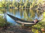 The hammock had been setup on Horseshoe. But, with the exception of the first day, the weather was such that we had little inclination to use it. With the nice weather this day we both took the opportunity to stretch out & relax. Relishing every moment.[paragraph break] Unbeknownst to me. Vickie had brought a friend. A stuffed lizard from home we call "Lizzie". Unfortunately portaging was not one of her strong points! lol
  And once again we were greeted by some feathered friends. As 2 mergansers swam by Vickie commented, "I don't think I've ever seen only 2 at a time? Usually when we see them there's at least a dozen grouped together!"
 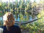 Almost directly south across the lake the most impressive cliff rose up adding ever more to wonderous ambiance of this special site.
  [paragraph break] The day was spent basking in the sunshine with no particular agenda. We had a nice supper of sausage with cheesy potatoes & onions on the side. By evening there wasn't a cloud in the sky. We sat by the fire with our beverages of choice & watched as the sun quickly sank in the western sky. There was a brief period of discomfort. This site is facing west. DIRECTLY west. Sitting in front of the firegrate as the sun set we couldn't avoid being nearly blinded from this vantage point. But after enduring the past couple of wet & cold days. This was almost a welcome nuisance.
 [paragraph break] Horseshoe Lake, Gaskin Lake, Winchell Lake
There being no blanket in the sky. The under armour proved it's worth yet again. Still it was tough to want to crawl out of the tent this morning. As we approached the firegrate area we quickly came to the realization we had a visitor in camp overnight. And apparently had gone through everything!  Jack Frost was his name. And there was clear evidence he'd stopped by as he left his calling card strewn about everywhere.[paragraph break] The first order of business was to get some water boiling for coffee & hot chocolate. Fortunately the fire took off right away and we huddled around it. The sky was clear and the sun was ever so slowly working it's magic. The lake was like a sheet of glass. Breakfast was once again leftovers from supper. Before too long it had warmed up sufficiently as to neglect the fire. We packed up Vickies' Duluth Pack in preparation for a trip to Davis lake.[paragraph break] Still quite crisp as we headed out. Paddling helped keep us comfortable. There is a neat island rising up out of the water as we paddled for the portage to Omega lake. As we paddled through, we trolled the length of Omega without success. There was only a little ripple on the water so the going was quite easy. Soon we were upon the portage to Kiskadinna. There was an overhanging birch tree above the trail. Seemingly serving as an archway?
 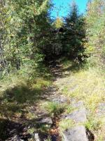 While only 35 rods long, this portages bite was definitely worse than its' bark! Started out nice enough but soon the steep ascent & equally steep descent on the other side made a person take notice. I was glad it was dry as there were a few large unavoidable areas of rock face that assuredly would have been quite slick in wet conditions. There is even a makeshift staircase on the Kiskadinna end.[paragraph break] We stopped to catch our breath a bit on the Kiskadinna end. Laughing, as that trail took us a little by surprise. There is a fairly decent landing on the Kiskadinna side though. As we were preparing to push off the stern of the Pearl was ever so slightly catching on a boulder. I told Vickie she could hop in. (the bow) She countered,"Aren't we on a rock back there?" I said, "Yes. But this end will rise up quite a bit when you get in so don't worry about it. I'll move it when I get in." It was immediately obvious that was not the best choice of words I could've used! Perhaps taking this whole Captain Morgan thing too literally? Vickie was using alot of language normally associated with a sailor. "OH! The canoes' back end will rise WAAAAAY up when I get in the front!" That wasn't the intention of that statement & regrettably I had to laugh........rather vociferously. Fortunately the better angels of our nature prevailed and we paddled on down Kiskadinna.[paragraph break] Kiskadinna seemed to me a minature version of Winchell. Long & narrow higher on the south shore lower & all the campsites on the north. We checked out both sites. The first (east) site wasn't much to get excited about. But the next one was quite nice.
  The best landing is back to the east a few rods from the front of the site. The firgrate area wasn't the best but everything else was really top notch. Lots of flat ground.[paragraph break] The portage into Davis was right where our map said it would be. That said it was a little difficult to discern where the trail starts. There was a small beaver dam just before the trail which started out on the right (west) side of the small brook that parrallels the trail for the first 100 rods or so.
  [paragraph break] The trail quickly crosses the brook at a very rocky intersection. In my opinion this is absolutely one of the toughest portages in the BWCAW. There are no long grueling climbs. Instead there are several shorter steep climbs coupled with a path generally in poor condition especially where the trail ran lose alongside the brook. Very rocky & wet. There were a few spots where it was tough to find the trail. Common sense prevailed. The trail improves the closer one gets to Davis lake. We saw several tracks along the way that we later identified as that of a Canadien Lynx. Davis lake was sparkling with diamonds providing a memorable & welcome initial unveiling.
  [paragraph break] Fishing on Davis was uneventful this day. We covered alot of water.....no luck. At least it was a beautiful day to be out on the water. I dare say it was hot. We pulled off to have lunch at the eastern most site. This was an absolutely awesome site!
  A great parking garage tht will provide a safe harbor in windy conditions. Superb tent sites & firegrate. There is a long walk to the latrine. Evidence of the 2006 famine fire is clearly visible nearby. But the site itself is unscathed. There were even various mooseplums scattered about the perimeter. I can't imagine there are an over abundance of visitors here? Tough portages in & out.
 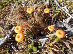 [paragraph break] After lunch we proceeded back towards Winchell. Came across the first people we'd seen all day on the portage from North Cone into Cliff. In fact the trail was saturated with travelers heading the other way. Memorably a couple of fellas really struggling to get over a fallen tree. It was a pleasant paddle the rest of the way home.[paragraph break] After getting back to camp & settling in. I pulled out a 6 pack of beer I had smuggled in. One, of many, great things about trips at this time of year is that you are almost always assured of a cold drink. We toasted to having been together for 1 year. We enjoyed the twinkling evening sky with a nice fire glowing nearby.
  [paragraph break] Winchell Lake, Omega Lake, Kiskadinna Lake, Davis Lake, North Cone Lake, Cliff Lake, Wanihigan Lake
Quite a bit warmer this morning. Largely due to the cloud cover that has had moved in over night. The uncertainty of how the weather would unfold this day? We resolved to keep close to home today & explore Winchell. [paragraph break] Looking at the map we noticed a small stream running out of Tremble lake emptying into Winchells' southern shore. It took a little bushwacking but after geetting through the initial scrub & cedar trees it was pretty easy going for not having a trail. 
 There was a small cascading waterfall here. This was quite a pleasant surprise. As we hadn't heard anything of this in our pre-trip planning. A really cool spot.[paragraph break] The next spot we headed for we had heard about. The cliffs on the south shore just across from our site. We had heard there was a trail leading up to the top. We had some difficulty finding this trail. There were a few different trails heading up just east of the cliffs. One that looked like it was made by the beaver living nearby. These trails just sort of fade away after 50 yards or so. Essentially we bushwacked our way to the top. We found out on our way down where the trail was. There were some large cedars down aross thr trail. Which make it very easy to lose the trail coming from the bottom. Basically what I'd tell anyone looking for this trail. Find one of the trails head straight up for about 50 yards then veer right (west) at about a 45 degree angle & work your way to the top. Even on the trail, which is barely discernable, it's going to be a tough climb.[paragraph break] As expected. Once topside we were afforded breathtaking views in 3 diretions.

 We even got a beautiful birdseye view of the peninsula our site was located on.
  [paragraph break] As we headed back down trying to find a trail. I stumbled upon, what I felt was, quite the find. An almost entirely intact moose shed! Only one of the tines was chewed away with only minimal marks on the rest. For having been shed 8-9 months prior. I felt it was still in pretty good shape. In keeeping with the principals set forth by the forest service. I LEFT NO TRACE that it was ever there:-)
 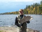 [paragraph break] Windy conditions suggested a weather change was imminent. We head back to camp. We spend the rest of the day shore fishing (with no luck) & playing cribbage. Sporadic rain finally dissipated by evening. And we were able to have a nice fire our last night on Winchell.
  [paragraph break] Winchell Lake
Photos available in her public albums on Facebook: http://www.facebook.com/album.php?aid=177073&id=595356145 http://www.facebook.com/album.php?aid=177127&id=595356145
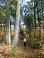
Day Zero (prep/travel day)[paragraph break] --------------------------[paragraph break] I arranged to work four 10-hour days at the office so I could take Friday off. We packed everything but the perishable food items during the week, so we could leave at midnight on Thursday. Thursday evening was a press to make sure all of our paperwork was in order so that my brother and sister-in-law could watch over the kids (i.e., notifications to the schools, medical power of attorney form), and then loading the car. I was then able to get a couple of hours of sleep before getting up at 11 PM, double-checking everything, and starting our drive to Ely. We were on the road just before midnight, but had to turn around for a couple of items--a bungee cord and a map--when we were just a few miles out of town. While returning home, we went over our checklist again. We didn't want to forget anything. Of course, the map wasn't where I left it, so we left without it. I figured signage along the route would be good (and it was).
While trying to pack light, I also wanted to err on the side of having enough so as to make sure my wife had a pleasant stay. We took in three packs: one large yellow vinyl dry pack (c. 35 lbs.) with the tent, sleeping pads, sleeping bags, and our clothes (rolled tightly and compressed in smaller nylon bags); a regular internal frame backpack (c. 45 lbs.) with our easily accessible gear (e.g., water filter, first aid kit, headnets) and some other items (e.g., cribbage board, hammock, rope, sandals, fishing tackle); and a bear barrel (starting c. 45 lbs.) for our food, cook kit, and other miscellaneous items. We packed two fishing rods into a light rod tube, and threw the reels into the bear barrel.
Our canoe was a borrowed 17' Alumnacraft. It was supposedly one of the lighter models (sub-70 lbs.), but I don't have an exact weight. For cooking, we packed in a homemade penny alcohol stove, four bottles of Heet, and about 8 oz. of extra alcohol fuel in another bottle. We brought a second alcohol stove along (a tuna can hobo stove) in case we wanted to be able to heat water for dishes while cooking, but we did fine with the penny alone. Our tent was an Alps Mountaineering Extreme 3 Outfitter model (with 10 kids at home, we opted for the outfitter option since it would see plenty of use) and a matching floor saver tarp/footprint.
Food was planned around simplicity. The first day had some summer sausage and cheese for lunch , and fajitas planned for dinner. Breakfasts on the other days were instant oatmeal and pre-cooked bacon. Lunches were typically Hudson Bay Bread and jerky. Dinners on days two and three were Tuna Helper, though we did plan for fried fish one night, if we were so lucky. We also packed in some assorted dry fruit for snacks, and I thought I'd score points by packing in a couple of fine dark chocolate bars.
My wife and I started running last fall, so we each had some tech clothes (e.g., synthetics) that we packed. We focused on layering, with fleece items for warmth and our rain jackets as the final layer. Beyond what we wore in, we packed only one change of clothes (the dry set in case of a dunking), an undergarment layer for sleeping, and those layers we did not immediately weary.
We live an hour west of Minneapolis, so our midnight departure time was designed to allow us a stop along the way, and time enough to pull over for a rest if I got too tired behind the wheel. Even with one stop of nearly an hour, we pulled into the Kawishiwi ranger station at about 6:40 AM on Friday, Day One.
Day One[paragraph break] -------[paragraph break] [Lake One] Our first good news came as we picked up our permit: the fire ban was being lifted as of Noon. I planned for the ban and had plenty of fuel, but was glad to hear that we could have a warming fire in the evening and morning. The only hiccough for us was that I planned that the ban would still be in effect, so I did not pack in a saw or a hatchet. While neither was necessary, they would have proved helpful.
Tom at the ranger station provided my wife with the most lively and entertaining review of the rules of any visit I've made into the BWCA. He really helped set her mood for the start of our adventure. Thanks, Tom!
We were out of there around 7:30 am, after our last pit stop, and on our way to EP30 (Lake One). The Fernberg road was smoother than I remember. Did they pave it since 2006? We were at the lake sometime after 8:15 AM. Another vehicle pulled up behind us and began started unloading their gear. We took our time, and figured we'd let them hit the water first. We imposed on one of them to snap a pre-entry photo for us. I loaded the gear into the canoe, and then gave my wife a primer on getting in and launching (especially once the gear was in place). We managed to be out on the water before 9 AM.
I chose the water route to the northeast rather than taking the three portages to the southwest. I figured that fewer portages would help my wife have a more enjoyable first day. It was pretty cool when we started--likely in the 40s (F), and the high never got above the 50s. We had a light wind from the start, so our rain jackets and life vests were on--every bit of insulation helped. I missed the narrows on that northern passage and ended up in the dead-end bay directly to the north of the passage. Water levels were clearly low, so we pondered a few moments as to whether we should carry our canoes over. The border marker for the BWCA obscured this section of the map pretty well. We doubled back and to the left (east) and found our narrows. We proceeded into Lake One, heading southwest and navigating around a long point and then turning south, and then southeast. The wind was picking up a bit, and a light rain began falling. I turned us west too early and ended up in another dead-end bay. I need to get used to the scale on the map in relation to the distance we've traveled. We paddled back west out of the bay, and then followed the southern shoreline until I reestablished our position. We paddled through a very rocky narrows into the bay we needed, and soon found our first portage trail. A single canoe had just cleared the portage, and a small group was just landing and starting a double-portage. We waited for a bit and then came ashore.
Being the first portage of the day, I had something to prove to myself, and a hope of keeping things easier on my wife. I threw the bear barrel on my back, our dry bag on my front. That's when we saw the occupants of that single canoe coming back across the portage trail. They were Forest Service employees. They wanted to check permits, and were informing everyone that the burn ban was being lifted at noon. I had just gotten both packs on, so I removed them and produced our permit. That slow-down left me standing, wet, in the wind and light rain, and I rapidly began to feel cold. They soon left us on our way, but I was thoroughly chilled. Part of the other group returned to get the last of their gear, so I re-donned the packs and then enlisted Marie's help to get the canoe positioned on my shoulders. The portage was only 30 rods, but that was long enough to make me realize that we, too, should double portage for the rest of the day.
The water was so low on the south end that the preceding group was still hung up on the rocks. As I approached the water, I scanned the shoreline. The area directly ahead of the portage was nothing but a rock garden. To the right (southwest), however, it was a bit deeper. I made my way over that way and floated our canoe. Marie was just behind me with the final pack, paddles, life jackets, and other miscellaneous items. We soon were in the water and on our way across to our next portage (40 rods). We did double portage here. I told Marie how far we had already come, and that we now had a significant paddle ahead of us (around 5 miles) before our next portage. I took the time to open one of our packs so as to find a couple of hand-warmer packets. I held them a few moments and then passed them on to Marie. She wasn't going to complain, but I could tell that she was feeling the cold, too.
[Lakes Two, Three, and Four] Passing through Lake Two was largely uneventful, other than the cold and the rain. By the time we were on Lake Three, the sun was peeking through the clouds from time to time. When we came to the narrows between Lake Three and Lake Four, our most direct route would have taken us between a large island and a point on the northern shore. Unfortunately, water levels were so low that the in-between space was now just an isthmus. We paddled back out and around, and I should have made a note for our return trip. A little more sun, then clouds, then rain, then sun... Marie had put on her sunglasses at one point, put took them off again when it clouded. Unfortunately, she had not put them on the neck strap we had for her. She slipped them into her pocket instead. At some point, they went over the side. That came back to bite us on the way out, when the glare prevented her from seeing shallow rocks until were were sometimes literally on top of them.
We finally reached the east end where three portages would take us into Hudson. Now, it seemed, no matter what the weather was while on the water, it always started raining when we hit the portages. As we approached the first one (25 rods), I noted that the rapids to the south were very small and slow, with calm water visible behind them. We decided to step out and pull the canoe over. Aside from wet feet on my end, that part of the plan worked well. Only afterwards did we realize, however, that a larger set of rapids was just upstream from that point. The water was so low that there was not much of a roar to warn us of the upstream barrier. Seeing that we could not pull through that one, we turned around and returned to the portage trail.
Surprisingly, our moods were good. Despite the rain, we were feeling warmer (likely from the preceding five miles of paddling since our first portages), and my wife enjoyed our little misadventure. I told her how, the last time I was here (in 2006) that the current at the top was so strong that it was very difficult to launch without getting pulled back toward the rapids. We made the launch just fine and portaged the next set (25 rods) without as much as thinking about going upstream. When we got to the third set of rapids (10 rods), at the west end of Hudson (or, should I say, the Kawishiwi leading into Hudson), we portaged again. When going back for our second trip, however, I noticed a single canoe headed toward a chute on the other side of a long, granite divide in the rapids. I chuckled to myself about my earlier mistake, and figured they'd be getting back to the portage head about the time we set into the water. As it turns out, while we were preparing to push off, they came into sight on the far side. They made it up the little chute. I congratulated them on their gumption, and made a note about the spot for our return trip.
We ate lunch along one of these portages. It was already after 1 PM.
[Hudson] The passage along Hudson was significant to me because it marked how far another group I was with got in on our first day back in 2006. We had much more rain and a driving wind that day, and some of our group were not well prepared for the weather. I remember being relieved to pull into camp, where we quickly pitched tents and got one of the teens into his sleeping bag for warmth. It was about this time I started to wonder if it was wise for us to push in further. After all, we'd need to paddle out on Monday, and it wouldn't work out well if it was going to take us ten or twelve hours to get back out.
At the same time, the portage to Insula was at the east end of Hudson, and that portage holds special significance for me. There, in 2006, when I began the decline within sight of the water on the east end, while carrying two packs, I slipped and broke my leg (the fibula, just above the ankle). One of my personal goals was to re-visit this portage and to make it across without injury.
I asked my wife a bit about her expectations for the rest of the trip. In particular, I asked her how important it would be to see the pictographs on Fishdance. I was hoping for an answer reflecting indifference, so I'd have a good reason to stop and camp on Hudson. As it was, however, she really was hoping to take that day trip, so I knew we needed to camp on Insula. Onward we went.
The portage itself (105 rods) went very well. Our two trips left us a bit tired, but it felt good to make it across. We stopped at the spot in the trail where I believe the break occurred and took some pictures. Since Marie had to set down her pack to take the photos, I picked it up when we were done, hoisted it onto my front, and made my way down to the water. I had beaten the beast.
[Insula] The portage to Insula took us quite a bit of time, and our hope for the sun winning out the afternoon were waning. We were now both quite tired, and the wind from the north-northwest was quite strong. Our immediate goal--finding a campsite--seemed simple. On a lake with dozens of sites, it should have been easy. We started out on an east-northeast bearing, but it soon was clear that most of the sites we encountered were facing the full force of the wind. Every time we had hope of finding a good site, we'd come across one either in the full face of the wind, or on an open and rocky point. We were moving slowly. The rain paused, but the winds were still strong and the cloud cover was thick, making it seem as if darkness would soon be upon us. I was worried about making camp while it was still light out, and in the back of my mind I was worried that we came in too far, and that we would never make it home on Monday if we didn't first relocate to another lake on Sunday morning.
Feeling desperate as we came through a channel between two large islands, I noticed that there should be two sites on the southern shore of the southern island. We turned south. and then southwest. It felt good once the shore broke the force of the wind. I scanned the map for nearby alternatives. If the first one didn't work, there were two others within a half mile: one further west, and another on an island to the southwest. When we got to the first site, Marie went ashore to confirm that it was a site. She saw the grate, so I immediately beached the canoe and began to unload. While she went to visit the latrine, I started gathering wood for a fire. I was cold and wet, and was not able to think clearly. I knew the dangers of hypothermia, but I never considered how horribly hypothermia can piggyback with exhaustion. I started a small fire and it puttered out--everything was too wet. I opened the bear barrel and took out my spare fuel. A little splash, and my next attempt stayed lit a while longer. Finally, desperate for the immediate warmth of a fire, I dumped the remainder of the spare fuel (6 oz.?) onto the bed of wet twigs, sticks, and wood. This time, it produced enough heat to get things going, but I immediately second-guessed my decision to waste the fuel. The cold was affecting my reasoning, but there was much yet to do. We got the tent up. Sleeping gear was unfurled. Wet boots and socks came off, but I had no energy to go into the gear bags to find my dry socks. Marie was warmer than me (those hand warmers were still going strong), but she was exhausted, too. We gathered some additional wood, and then just sat together near the fire. It was around 4:30 PM when we landed. Our thoughts turned to dinner. We pre-cut and then froze a bag of peppers and onions for fajitas, and although a warm meal sounded great, neither of us had the energy to cook and clean. We decided to postpone our big dinner until the next day, and simply ate cheese, Hudson Bay Bread, and summer sausage. We didn't even make coffee. Honestly, much of the rest of that evening is a bit fuzzy in my mind. Boots, shoes, and socks were left drying by the fire. The canoe was pulled further ashore and turned over against a downed log. We tucked the bear barrel under the high end of the canoe (figuring any attempt to get to the barrel would bang around the canoe and wake us up), and turned in. It felt good to slip into dry night clothes. Heading up, I heard that frost was possible, so I made sure we both were well covered. I donned a fleece balaclava to keep my head warm (otherwise, I tend to wake up with a headache) and faded off to sleep. I checked on the Mrs. frequently during the night to make sure she was still warm. At one point, I discovered that her bag was unzipped part way. I zipped it up, strapped the zipper in place, and tightened down the hood on her mummy bag. She slept well during the rest of the night. Our first day was done.
Day Two[paragraph break] -------[paragraph break] By mutual decision, this was designated our lazy day. We decided to stay in camp and do nothing in particular (a real treat for parents with 10 kids at home). I was up with the birds, but Marie had no interest in being up that early. I was tempted to resent her for it, but then remembered that this was a trip she hoped to enjoy, too. Everything was covered in frost, and the waters were adorned in their foggy shrouds. I pulled our gear from the vestibule, got the fire started, shot a few photos, and checked on my boots (still wet, of course). Once the fire was going, I propped a long driftwood branch over the grate to dry the socks, and I moved my boots into the light of the rising sun. I cut rope to hang my hammock, and strung a clothes line. I searched for more firewood and lamented that I had no axe or saw. There were many downed trees, but I had no way to cut good fuel logs for a long burn. After some time, thinking a couple of hours passed since dawn, I boiled water for coffee and woke Marie as I started the water for our oatmeal. It started cold, but warmed into the 70s (F) by midday. The hammock was up and well-used during the day. Marie hiked into the woods on her own with the camera, and I just hung around camp. I eventually strung my rod and spent some time fishing. The fishing was good, but catching could have used some action.
We talked about pulling out earlier on Monday morning, or perhaps jumping back to Hudson on Sunday afternoon. We decided to wait on making a decision. The canoe stayed beached all day. Marie read her book, and I enjoyed my hammock and listening to the birds. Winds came out of the southwest, rocking my hammock ever so gently. Whether there by nature or due to another camper's efforts, there was a large rock positioned perfectly next to my hammock, and my mug found its home there during the day.
What else can I say? For a married couple with a large family, we couldn't have asked for a better way to spend a day. Since we skipped the fajitas the night before, we made them for lunch. The afternoon passed much the same way as the morning. I saw one canoe during the day, and heard one or two other groups somewhere on the lake, when the wind carried their conversations to me. Aside from that, it was a quiet and cozy little place. Afternoon sun made sure my boots were dry, and our primary concern was to make sure we left nothing out and about that could be blown away.
Afternoon gave way to evening, and we made Tuna Helper for dinner. We built up the fire and then became reacquainted with cribbage (it had been years since we last played). We stayed out until it was getting too dark to see the cards, and then turned in for the night. It was cool, but not as cold as the night before.
Day Three[paragraph break] ---------[paragraph break] We woke up to tolerable temperatures in the 40s. We both were relieved that there was no frost. Once again, oatmeal and bacon were for breakfast. It's a meal combination our friend Tom (not to be confused with Ranger Tom) uses regularly on the trips he leads, and I must admit it is one of my favorites. The press pot I picked up for coffee was much nicer (in my opinion) than using a percolator, and we enjoyed our cups-o-Joe. We decided to take a trip to Fishdance, one of the options we had discussed much before coming, so we packed lunch, our water filter, and our first aid kit into a day pack and set out as soon as dishes were done.
The real blessing of the morning was that it remained calm. Once the sun came up, I expected morning winds to increase, but as we pushed off from shore, the only ripples were those caused by our canoe and the paddles. To a great degree, that's how the waters remained as we traversed Insula. In addition to the Fishdance pictographs, we had also talked about visiting "The Rock". It was one of the stops I made with our group in 2006, and it seemed like an enormous cliff face towering hundreds of feet above the lake. Of course, at that time, I was paddling with my broken leg splinted with two pieces of beaver wood, and we were against strong winds and huge waves on Insula. When we finally reached "The Rock" in 2006, my partner and I battled the wind to get around to the northwest corner where we found a slope I could ascend. The entire experience made a monument out of the place in my memory. Needless to say, Marie and I both were underwhelmed when we passed it on our little trip.
I decided to approach it from the west, so we went northwest into Insula until we came to a narrows due west of "The Rock". As we turned east and headed into the narrows, it became clear that the low water levels were once again at play. We made an unexpected portage where land had replaced water, and continued on. Since we wanted to be sure we would make it to the picture rocks (almost nine miles from camp), we decided to pass on "The Rock" and we continued on to the north and northeast. We crossed big water that was mostly calm--only disturbed by an occasional breeze. We encountered two other paddlers (before we turned north to the stretch with Williamson I) who just broke camp and were heading in through Alice. We were both surprised that they didn't pull ahead of us too quickly. They only got away when we stopped to photograph some eagles and turkey vultures.
We entered the Kawishiwi after lingering with our photographic subjects, and enjoyed the calm. We could hear a bit of wind picking up through the trees, but it was not reaching us on the river's placid surface. The water level here was still markedly low, but the lake above the southern hillside had to be overfull, as rivulets and streams were rushing down into the river anywhere the terrain created a gully or crevasse. Here we began to see some congestion--lone canoes stretched along the river, each carrying eager fishers on Minnesota's fishing opener weekend.
We entered Alice and headed east, following the Kawishiwi toward our next set of portages. Each of the campsites along this stretch were occupied, and we saw more people fishing the river. As we approached the first pool below rapids, two canoes and a kayak held position as their occupants fished. Above the portage (20 rods), more canoes floated while their occupants fished. We quickly paddled through and embarked on the toughest porta
As planned we got up early had a quick breakfast of oatmeal & were on our way. We had heard strong gusts of wind throughout the night which continued through the morning. But Carl itself is quite calm. The strong winds are up in the clouds as they streak by. The portage into Morgan was different. Rocks need to be avoided as we approahed into a swampy area complete with cattails.  Obviously the trail was wet except for the last few rods to Morgan. [paragraph break] The strong winds had little effect on Morgan as well. It looked like there were 2 layers of clouds. The sun tried desperately to come out but ultimately the clouds overtook her.
  In no time we were at our final portage trail. We didn't quite beat the rain. The last leg of the portage it started to sprinkle gradually gaining momentum. By the time we reached the vehicle there was a good old fashioned soaker in progress. We changed into dry clothes in the vehicle. (Thankfully no one pulled up ;-)[paragraph break] We drove into town in time to catch the lunch buffett at Sven & Oles'. From there it was homeward bound to Clearwater. AYE! ITWER A GREAT TRIP MATEY!![paragraph break] Carl Lake, Morgan Lake